9TH – 11TH DECEMBER 2019
SEMINAR HALL – IIT DELHI, INDIA
PLACE VS. SPACE IN AUTHORITY DATA: ENHANCING LIBRARY RETRIEVAL THROUGH GEODETIC SEARCH

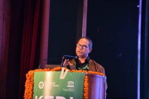
PARTHASARATHI MUKHOPADHYAY
Professor, Library and
Information Science, University of
Kalyani, West Bengal
10th Dec
5:00PM-5:40PM
Parthasarathi Mukhopadhyay is a Professor in Library and Information Science And presently Head, Department of Library and Information Science, Kalyani University. Prof.Mukhopadhyay, a recipient of Best Young LIS Teacher award (IASLIC), is an open source enthusiastic and worked as a developer and promoter of many open source projects. He has more than 100 papers in journals and conference volumes and five books in his beeline.
His recent book on Interoperability and Retrieval is published by UNESCO, Paris. Prof. Mukhopadhyay acted as metadata consultant for the project NDL (National Digital Library) hosted by IIT, Kharagpur. He is presently a member of the Advisory Committee for National Virtual Library Project of Ministry of Culture, Govt. of India.
ABSTRACT
Authority data management is an intrinsic attribute of library retrieval. Basically there are three sets of authority data that influence efficiencies of a typical library retrieval system namely name authority, subject authority and title authority. Geographic name authority datasets are hugely important for the retrieval of certain types of documents where place names and/or geographical locations are playing primary roles in retrieval. There is a basic differentiation between place and space. The place is a cultural concept whereas Space is a physical concept. On the other hand, place names tend to be multiple, equivocal, and changeable due to various sociocultural issues. For example, the place can be changed by both names and boundaries. Space, is a more modern concept and is more stable. Places include spaces and thereby two or more places can be linked to each other by reference to a common system of spatial description. This is called georeferencing and is expressed in terms of latitude and longitude. Georeferencing allows both location and spatial relationships to be visualized in map displays.
Information retrieval in digital and automated libraries of any type or size to date centers around only textual search in spite of tremendous advancements in digital information representation and retrieval. Geographic authority data encoding and retrieval is no exception to this trend. This deliberation is an attempt to enhance information retrieval features of a typical digital library search system by fusing geodetic search capabilities in it. A geodetic search framework is a kind of land-information system. In such systems locations are determined with the help of mathematical framework for spatial referencing of all land data to recognizable positions on the Earth’s surface. A geodetic search framework in bibliographic domain need to additionally support following activities – a) extracting longitudes and latitudes (may be repeatable means may occur more than once in a single document) encoded in metadata; b) integrating Geo-coordinate values with the map service in use; and c) exposing geodetic data-sets in the search interface to filter search results.
This prototype framework applies a Solr-based open source library discovery software namely VuFind as retrieval system, Leaflet an open-source JavaScript library for interactive maps, OpenStreetMap as cartographic data provider available under Open Data Commons Open Database License (OdbL). It can handle records formatted in Dublin Core (Qualified) metadata schema and MARC 21 format for bibliographic data and thereby ensures its applicability for both automated and digital library spheres. These mechanisms may help libraries going beyond text only search and may prove an effective measure in the retrieval of documents and datasets where Place or Geographic name is the focus like knowledge objects in the domain of geography, geology, travel guides, etc.
PRESENTATION
Place Vs. Space in Authority Data: Enhancing Library Retrieval thorugh Geodetic Search


